We Turn Location Data Into Decisions
Our GIS and geospatial solutions empower organizations to visualize, analyze, and act on geographic information. From precision mapping to advanced spatial analytics, we deliver insights that drive smarter planning, resource management, and operational efficiency.
Our GIS & Geospatial Services
GIS Mapping & Cartography
Create precise, visually compelling maps that communicate complex spatial data clearly — from topographic surveys to urban planning layouts.
- Topographic & thematic mapping
- Land use & land cover mapping
- Custom cartographic design
Remote Sensing & Satellite Analysis
Harness the power of satellite imagery and aerial data to monitor land changes, vegetation health, and environmental conditions at scale.
- Multispectral & hyperspectral analysis
- Change detection & time-series analysis
- NDVI & vegetation index mapping
Spatial Data Analysis
Unlock patterns hidden in geographic data with advanced spatial analytics — supporting decision-making in agriculture, infrastructure, and urban development.
- Terrain & watershed analysis
- Network & proximity analysis
- Geostatistics & hotspot mapping
Web GIS & Application Development
Deploy interactive, web-based GIS platforms that allow your team and stakeholders to explore spatial data anywhere, anytime.
- Custom web map portals
- ArcGIS & QGIS integrations
- Real-time geospatial dashboards
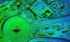
Drone Surveying & UAV Mapping
Capture high-resolution aerial data with UAV technology for surveys, site inspections, 3D modeling, and volumetric calculations.
- Photogrammetry & orthomosaic maps
- 3D terrain & point cloud models
- Construction & mining site surveys
GPS & Field Data Collection
Collect accurate ground-truth data using GPS and mobile GIS tools, seamlessly integrated into your existing spatial workflows.
- GPS field surveys & data capture
- Mobile GIS app integration
- Asset & utility mapping
Our Precision-Driven Workflow
We follow a rigorous, science-backed workflow that ensures the highest accuracy in every geospatial deliverable — from raw data acquisition to final analysis and reporting.
1 Data Acquisition
We collect spatial data through satellite imagery, UAV surveys, GPS field collection, and existing datasets.
2 Data Processing
Raw data is cleaned, georeferenced, and processed using industry-standard GIS tools and remote sensing software.
3 Spatial Analysis
We apply advanced spatial algorithms, modeling techniques, and overlay analysis to extract meaningful insights.
4 Delivery & Reporting
Final outputs — maps, dashboards, reports, and geodatabases — are delivered in your preferred formats with full documentation.
Our GIS Project Outcomes
Measurable impact across industries and geographies
500+
Geospatial projects delivered across sectors
95%
Mapping accuracy rate across all survey projects
30+
Countries covered through satellite & remote sensing work
+70%
Average improvement in decision-making speed for clients
Industries We Serve
Our geospatial expertise spans a wide range of sectors
Agriculture
Urban Planning
Environment
Construction
Utilities
Defence & Security
Ready to Map Your Way to Better Decisions?
Let's discuss how our GIS and geospatial expertise can solve your toughest spatial challenges.
Schedule a Free Consultation